Open Forest Observatory creates new tools for better forest management
UC Davis team builds drone mapping platform and public database
Environmental managers will have a powerful new resource for helping our forests survive and recover from wildfire, drought and disease.
UC Davis ecologist Derek Young is leading a team to develop the Open Forest Observatory, a pioneering project combining drone photography and forest mapping with machine learning, remote sensing, big-data crunching and open information sourcing. The observatory will offer technology so friendly that users will need only a few weeks to learn it, instead of a year. And, for the first time, the project will make the resulting database available in a central repository.
“We'll be producing the data and the tools to help others address vexing forest ecology and land management questions,” explained Young, an assistant professional researcher with the Department of Plant Sciences.
A $1-million grant from the National Science Foundation is funding the observatory over five years, including work at two partner institutions. It takes off this month, offering the potential to lift ecological research to new heights.
New process, technology, availability
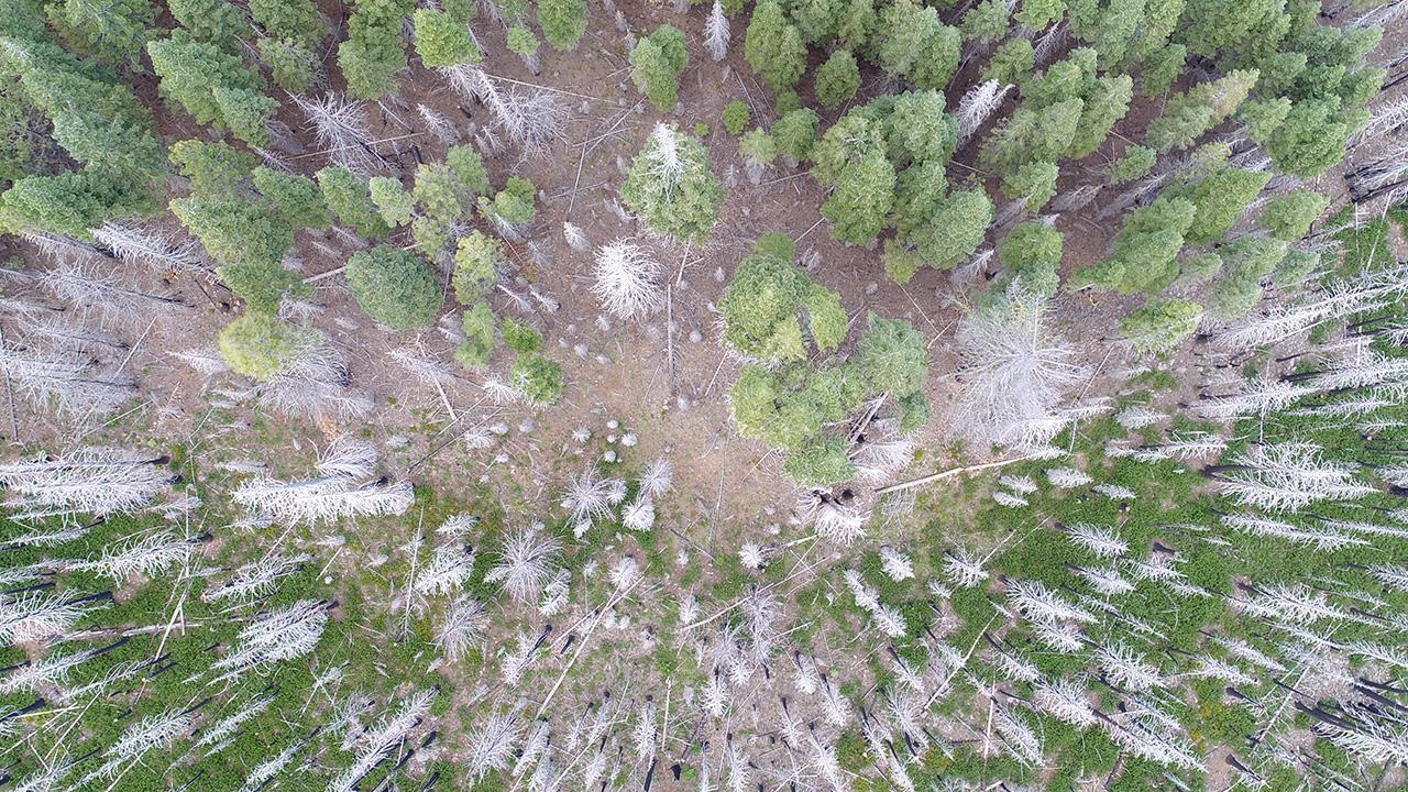
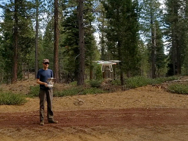
Thanks to high-definition cameras now available on drones at relatively low cost, the observatory will host a database of detailed, on-the-ground information, down to the sizes, species and health of individual trees.
Young’s team will develop software for creating these maps using best practices in drone-based forest imaging; as part of their previous work, they comprehensively codified those practices for the first time. Researchers and forest managers will be able to access the observatory’s maps to answer their own questions, or use its tools to produce new maps and share them through the observatory.
The result will be massive amounts of information, organized to allow all kinds of variables to be compared over space and time.
And, this new research tool will be made widely available. “By building this project with an open science ethos, we’ll be intentional about sharing our data and methodology, which will further democratize access to cross-scale research of critical forest ecosystems,” said project co-lead Michael Koontz, of the University of Colorado and a UC Davis alumnus.
The project also will offer drone pilot training for UC Davis students, plus drone piloting and forest mapping concepts to high-school students in towns affected by wildfire, Young added.
Wrestling forest density
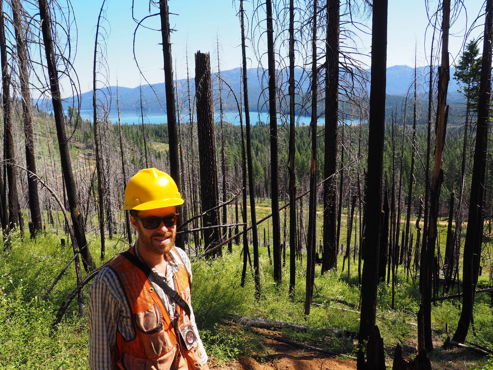
The observatory can help scientists wrestle urgent problems, such as how to thin dangerously dense forests despite insufficient budgets.
“Forest thinning in the densest stands in the driest locations will be an effective way to reduce tree mortality during extreme drought,” Young said.
In many areas, trees are growing up to 400 per acre, compared to 80 per acre in a healthy forest, according to the Sierra Nevada Conservancy. With 25 million forested acres in the Sierra Nevada, tree density raises wildfire risk and endangers watersheds up and down the range – and water supply for three-quarters of state residents.
“It’s one of the biggest challenges that natural resource managers are facing right now,” Young said.
The team’s grant also includes looking at how – and whether- new trees sprout in burned areas. They’ll start with maps created before a fire, then revisit the area to map surviving trees.
“To predict how seeds will disperse into these burned areas, you need to know where the surviving trees are, how they are arranged spatially, what species they are and how dense they are,” Young said. Burned areas could be tracked into the future to see how long survivors last and how quickly new vegetation establishes.
Tyson Swetnam will spearhead data storage and processing through the University of Arizona’s CyVerse initiative, a platform for cloud-based computation and analysis. Koontz will head development of the open, reproducible workflow to create digital maps, plus training to use them, through CU’s Collaborative Institute for Research in Environmental Sciences.
Related links
- Open Forest Observatory: https://openforestobservatory.org/
- Young and Koontz recently published a related paper on drone-based forest mapping, detailing the basis for their NSF project, including best practices that they comprehensively codified for the first time: https://besjournals.onlinelibrary.wiley.com/doi/10.1111/2041-210X.13860
- A short video of Young launching a drone: https://drive.google.com/file/d/1aHacCCZDdh1IkFgcFT6DH-Aa7lBsidOV/view
Media Resources
- Derek Young, UC Davis Department of Plant Sciences, djyoung@ucdavis.edu
- Trina Kleist, UC Davis Department of Plant Sciences communications, (530) 601-6846